
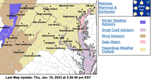
WIND ADVISORY
URGENT – WEATHER MESSAGE
National Weather Service Baltimore MD/Washington DC
1258 PM EST Thu Jan 19 2023
Augusta-Rockingham-Northern Virginia Blue Ridge-
Central Virginia Blue Ridge-
Including the cities of Staunton, Waynesboro, Stuarts Draft,
Harrisonburg, Big Meadows, and Wintergreen
1258 PM EST Thu Jan 19 2023
…WIND ADVISORY REMAINS IN EFFECT FROM 4 AM TO 4 PM EST FRIDAY…
* WHAT…West winds 20 to 30 mph with gusts up to 50 mph
expected.
* WHERE…Augusta and Rockingham Counties, and Northern Virginia
Blue Ridge and Central Virginia Blue Ridge.
* WHEN…From 4 AM to 4 PM EST Friday.
* IMPACTS…Gusty winds could blow around unsecured objects.
Tree limbs could be blown down and a few power outages may
result.
* ADDITIONAL DETAILS…The highest winds are expected over and
just east of ridges that are taller than 1500 feet..
PRECAUTIONARY/PREPAREDNESS ACTIONS…
Use extra caution when driving, especially if operating a high
profile vehicle. Secure outdoor objects.
URGENT – WEATHER MESSAGE
National Weather Service Blacksburg VA
1202 PM EST Thu Jan 19 2023
Ashe-Alleghany NC-Watauga-Tazewell-Smyth-Bland-Giles-Wythe-
Pulaski-Montgomery-Grayson-Carroll-Floyd-Craig-Alleghany VA-Bath-
Roanoke-Botetourt-Rockbridge-Bedford-Amherst-Mercer-Summers-
Monroe-Eastern Greenbrier-Western Greenbrier-
Including the cities of West Jefferson, Sparta, Boone, Tazewell,
Marion, Bland, Pearisburg, Wytheville, Radford, Pulaski,
Blacksburg, Independence, Whitetop, Troutdale, Volney, Galax,
Floyd, New Castle, Clifton Forge, Covington, Hot Springs,
Roanoke, Salem, Fincastle, Lexington, Buena Vista, Bedford,
Amherst, Bluefield, Flat Top, Hinton, Hix, Union, Lewisburg,
White Sulphur Springs, Alderson, Quinwood, Duo, and Rainelle
1202 PM EST Thu Jan 19 2023
…WIND ADVISORY NOW IN EFFECT FROM 4 PM THIS AFTERNOON TO 4 PM
EST FRIDAY…
* WHAT…West winds 15 to 25 mph with gusts up to 50 mph
expected.
* WHERE…Portions of northwest North Carolina, southwest, and
southeast West Virginia, along and west of the Blue Ridge.
* WHEN…From 4 PM this afternoon to 4 PM EST Friday.
* IMPACTS…Gusty winds could blow around unsecured objects.
Tree limbs could be blown down and a few power outages may
result.
PRECAUTIONARY/PREPAREDNESS ACTIONS…
Use extra caution when driving, especially if operating a high
profile vehicle. Secure outdoor objects.
