UPDATE Nelson County Life Magazine HERE
Updated 8:25 AM EST
WINTER STORM WATCH : BEGINS THURSDAY MORNING CLICK HERE FOR WATCH DETAILS
Weathercast by Tommy Stafford, Nelson County Life Magazine
DON’T WANT TO READ THE FORECAST? SIT BACK AND
LISTEN TO OUR AUDIO VERSION BY CLICKING THE RED PLAY BUTTON BELOW!
(Mac users may need to have Safari open to see the play button if you are using Firefox browser)
Older version of audio player:
Photography By Tommy Stafford
Nelson County Life Magazine ©2008
Skiing At Wintergreen
Wintergreen Mountain, Virginia
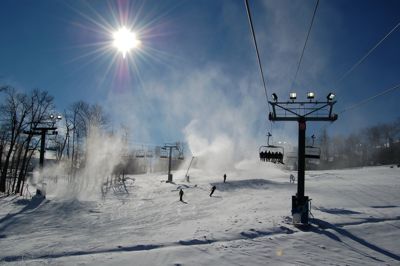


Click the image above for the ski and slope conditions at Wintergreen Resort.
Tuesday’s High/Low at NCL-Nelson County Life Magazine in the Rockfish Valley : 40° / 29°
Tuesday”s High/Low at NCL-Wintergreen Nature Foundation on Devil’s Knob @ Wintergreen Mountain : 23° / 15°
Tuesday was a pretty blustery day across Central Virginia and Nelson County. Some snow showers managed to make it over the Blue Ridge just before noon to give folks a glimpse of some snow showers before skies became partly sunny for the remainder of the day. Temps struggled to make it out of the 30’s all day in the valley and finally reached 40° briefly. Upon the mountain the temp never cracked the 25° mark, only reaching a high of 23 degrees after a morning low of 15°.
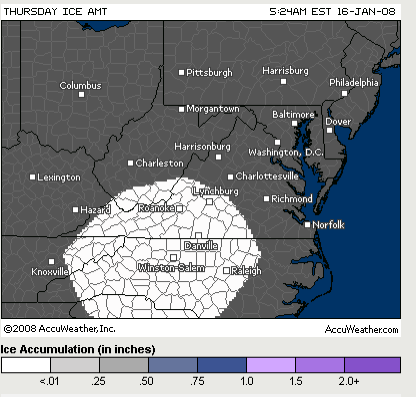
Wednesday will be a fairly quiet day with slightly warmer readings than yesterday. Overall a day of tranquility before the forecast gets interesting and challenging for the next 36 hours. By now most folks have heard about the possibility of winter weather Thursday. There is a distinct possibility and as I mentioned yesterday these things are very difficult to predict in the mountains. No one, including me, though the brief snow showers would have made it over the BRP Tuesday morning, but they did. It’s nature you know! With all of that being said, I continue to say Thursday’s round of winter time fun bears watching. Temperatures are critical on this, as is the path of a developing low that will scoot up the eastern seaboard. Many models and forecasters are conflicted on this one. The general consensus as of Tuesday night … the timing of the moisture’s arrival and temps won’t be just right so it could be simply rain or turn to rain. That’s below, I think in the mountains, yes Wintergreen, if we get the moisture you’ll have snow above 2000 feet. I am not ready to commit on this one just yet, but I will be updating often Wednesday, as I usually do when we have a potential winter storm developing. Again, I am concerned with icing potential on this system. Temps are teetering on the freezing mark in the valley during the event, so that could mean snow, sleet, and freezing rain at one time or another. Best to keep checking back here, I will be putting up the latest data.
Here’s the best bet that AccuWeather.com forecasters had for frozen precip as of late Tuesday. I will update these Wednesday as well.
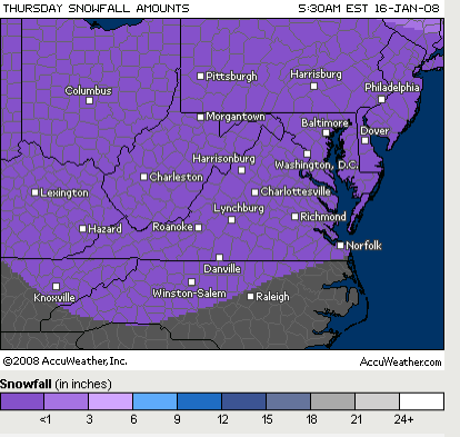

Thursday Snow Potential via AccuWeather.com
Friday the system begins moving away by noon with gusty northerly winds kicking in. By the weekend get your long johns handy, throw a log on the fire, and cuddle! It’s going to be cold…VERY! Temperatures of 10-15 degrees will be common in the valley at night for the weekend, with 0-5° readings on the mountains. It will never make it above freezing Sunday and just barely Monday in the valley. By Tuesday snow chances work back in the forecast.
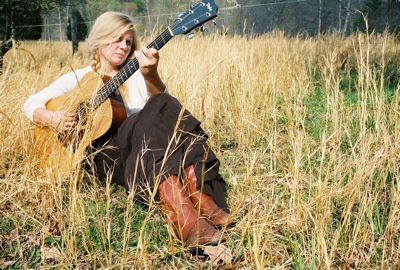
We continue with our look & listen of local Nelson music artists. The rest of this week and weekend we’ll be hearing tracks from singer / songwriter Lindsey Osborne’s collection. Be sure to check out Lindsey’s info below and stay tuned to hear today’s cut as we head out of weather.
Regional Current Surface Map via wunderground
![]()
Looking Ahead


And for those of you keeping score at home check the detailed numbers at any of our reporting NCL-Weathernet Stations for real up to the minute live weather data and detailed information including highs, lows, wind speeds, rainfall and much, much more, simply use the handy drop down menu on the upper left hand side of your screen.
Your Nelson County Life custom area forecast including: Wintergreen, Lovingston, Crozet & Covesville
Wednesday: Mostly sunny slightly warmer.
* Highs Valley: 41-44°
*On the mountains: 28-31°
*Winds: NW-5 MPH becoming SE in the afternoon.
*OVERNIGHT: Becoming mostly cloudy overnight, wintry mix possible by daylight. Lows valley: 27-30° : Mountains: 19-22° : Winds: S-5 MPH
Thursday: Winter Storm Watch : Snow likely in the morning mixing with rain and snow later in the day over 90% of the area. Freezing rain possible late afternoon. 1 to 3 inches accumulation possible
* Highs Valley: 34-37°
*On the mountains: 30-33° Snow beginning around daylight and continuing throughout the day. 2 to 4 inches accumulation possible
*Winds: E-5 MPH
*OVERNIGHT: 70% Snow, sleet & freezing rain continues valley. Snow mountains. Lows valley: 30-33° : Mountains: 27-30° : Winds: NE-5 MPH
In the extended period: Friday look for a wintry mix early then becoming partly cloudy with gusty WNW winds by afternoon. Highs valley in the mid 40’s – mountains mid 30’s.
By the weekend Saturday, skies are generally partly sunny with highs valley in the upper 30’s and upper 20’s mountains. Overnight lows 10-15° valley, single digits mountains. Sunday afternoon highs remain in the mid 20’s valley and around 15° mountains. Overnight into Monday morning look for a valley low of around 10° and from 0-5° on the mountain.
By MLK on Monday look for highs around 35° down below and around 30° mountains. Snow possible again by Tuesday of next week.
As promised Lindsey Osborne takes us out with, a cut from her latest collection of songs. This one is called Godspeed.
Have a great Wednesday everyone!
Know your Nelson.COM
Visit Lindsey’s Homepage by clicking right here to learn more about her.
Catch Nelson native, Lindsey Osborne, at Basic Necessities on Friday January 18th and at Rapunzel’s Coffee and Books on Friday March 28th.

