
WINTER WEATHER ADVISORY
URGENT – WINTER WEATHER MESSAGE
National Weather Service Baltimore MD/Washington DC
534 PM EST Tue Jan 31 2023
Augusta-Rockingham-Page-Western Highland-Eastern Highland-
Central Virginia Blue Ridge- (including Wintergreen)
534 PM EST Tue Jan 31 2023
…WINTER WEATHER ADVISORY IN EFFECT FROM MIDNIGHT TONIGHT TO
9 AM EST WEDNESDAY…
* WHAT…Mixed precipitation expected. Total snow accumulations
of up to one inch and ice accumulations of a light glaze.
* WHERE…Augusta, Highland, Page, and Rockingham Counties and the
central Virginia Blue Ridge.
* WHEN…From midnight tonight to 9 AM EST Wednesday.
* IMPACTS…Plan on slippery road conditions. The hazardous
conditions could impact the Wednesday morning commute.
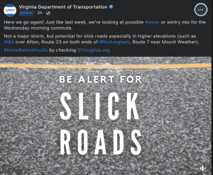
* ADDITIONAL DETAILS…The greatest chance for snow and ice
accumulations will be in the higher elevations.
PRECAUTIONARY/PREPAREDNESS ACTIONS…
Slow down and use caution while traveling.
When venturing outside, watch your first few steps taken on
steps, sidewalks, and driveways, which could be icy and slippery,
increasing your risk of a fall and injury.
&&
$$
URGENT – WINTER WEATHER MESSAGE
National Weather Service Baltimore MD/Washington DC
534 PM EST Tue Jan 31 2023
Northern Virginia Blue Ridge- Including Big Meadows
534 PM EST Tue Jan 31 2023
…WINTER WEATHER ADVISORY IN EFFECT UNTIL 9 AM EST WEDNESDAY...
* WHAT…Mixed precipitation expected. Total snow accumulations of
up to one inch and ice accumulations of a light glaze.
* WHERE…Northern Virginia Blue Ridge.
* WHEN…Until 9 AM EST Wednesday. Freezing rain or drizzle is
likely this evening before changing to snow overnight.
* IMPACTS…Plan on slippery road conditions.
PRECAUTIONARY/PREPAREDNESS ACTIONS…
Slow down and use caution while traveling.
When venturing outside, watch your first few steps taken on
steps, sidewalks, and driveways, which could be icy and slippery,
increasing your risk of a fall and injury.
FREEZING PRECIPITATON FORECAST WEDNESDAY MORNING
Motorists should monitor weather overnight, check 511 for latest road conditions
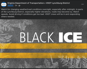
CULPEPER — Crews with the Virginia Department of Transportation will be on duty overnight as light snow, sleet and freezing rain are forecast for parts of Piedmont Virginia Tuesday night and early Wednesday morning.
Rain is falling across the Piedmont region and is forecast to change to snow and a frozen mix early Wednesday through the morning commuting hours in the counties closest to the Blue Ridge Mountains. Freezing rain can quickly make roads icy and slick and is extremely hazardous for all drivers, even in four-wheel and all-wheel-drive vehicles.
Ice is likely to form first in areas where pavement temperatures are lowest. These spots include bridges, overpasses, and ramps and at elevations such as the mountain passes on Interstate 64 and U.S. 250 in Albemarle County, U.S. 33 at Swift Run Gap in Greene County, U.S. 211 at Thornton Gap and U.S. 522 at Chester Gap in Rappahannock County.
If travel is necessary Wednesday morning, drivers should pay attention to local weather forecasts and road conditions and plan to use extreme caution as road conditions may deteriorate quickly. Prior to travel, motorists should visit 511virginia.org, call 511 or check the 511 Virginia mobile app for up-to-date information on road and traffic conditions.
In the nine counties of the Culpeper District crews will be working overnight and will spread salt and sand to improve traction and melt ice when frozen precipitation begins. Since the storm began as rain on Tuesday brine was not used for this event since the rain would have washed it off the roads, rendering it ineffective.
Safety and Travel Resources
When winter weather arrives, residents and motorists should plan travel ahead of time, check road conditions, prepare an emergency car kit, follow forecasts and announcements and limit travel based on conditions.
Local updates about conditions in VDOT’s Culpeper District are posted to Twitter.com/VaDOTCulp.
Visit VDOT’s winter weather page for more information about winter weather preparations and response.
For questions or to report hazardous road conditions, the public should contact VDOT’s 24-hour Customer Service Center by visiting my.vdot.virginia.gov or calling 800-FOR-ROAD (367-7623).
