
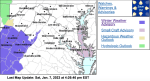
WINTER WEATHER ADVISORY
Central Virginia Blue Ridge-
Including the city of Wintergreen
332 PM EST Sat Jan 7 2023
…WINTER WEATHER ADVISORY IN EFFECT FROM 10 AM SUNDAY TO
MIDNIGHT EST SUNDAY NIGHT…
TONIGHT…Mostly clear. Lows in the upper 20s. North winds 5 to
10 mph.
.SUNDAY…Partly sunny with a chance of freezing rain and snow in
the morning, then cloudy with snow, freezing rain, rain with a
slight chance of sleet in the afternoon. Snow and sleet
accumulation around an inch. Ice accumulation around a trace.
Highs in the lower 30s. South winds 5 to 10 mph. Chance of
precipitation 80 percent.
.SUNDAY NIGHT…Rain. Freezing rain likely in the evening, then
freezing rain after midnight. Lows in the lower 30s. South winds
5 to 10 mph, becoming west after midnight. Chance of
precipitation 80 percent.
.MONDAY…Sunny. Highs in the mid 40s. Northwest winds 10 to
15 mph with gusts up to 25 mph.
.MONDAY NIGHT…Mostly clear. Lows in the upper 20s.
.TUESDAY…Partly sunny. Highs in the mid 40s.
.TUESDAY NIGHT…Mostly cloudy. Lows around 30.
.WEDNESDAY…Mostly sunny. Highs in the mid 40s.
.WEDNESDAY NIGHT…Partly cloudy. Lows in the lower 30s.
.THURSDAY…Partly sunny. Highs in the mid 40s.
.THURSDAY NIGHT…Mostly cloudy with a chance of rain and snow.
Lows in the mid 30s. Chance of precipitation 40 percent.
.FRIDAY…Rain likely. Highs in the lower 40s. Chance of rain
60 percent.
URGENT – WINTER WEATHER MESSAGE
National Weather Service Baltimore MD/Washington DC
258 PM EST Sat Jan 7 2023
Augusta-Western Highland-Eastern Highland-
Central Virginia Blue Ridge – (Including Wintergreen)
258 PM EST Sat Jan 7 2023
…WINTER WEATHER ADVISORY IN EFFECT FROM 10 AM SUNDAY TO
MIDNIGHT EST SUNDAY NIGHT…
* WHAT…Mixed precipitation expected. Total snow and sleet
accumulations of up to one inch and ice accumulations of around
one tenth of an inch above 1500 feet.
* WHERE…Augusta, Western Highland and Eastern Highland
Counties, and Central Virginia Blue Ridge.
* WHEN…From 10 AM Sunday to midnight EST Sunday night. A wintry
mix of snow, sleet, and freezing rain will overspread the area
late Sunday morning into Sunday afternoon between 11 AM and 2
PM. Temperatures above 1500 feet will be around 30 to 32
degrees. Temperatures in the valleys below 1500 feet will be in
the mid to upper 30s, so any snow or sleet accumulation will be
light and freezing rain is not expected.
* IMPACTS…Plan on slippery road conditions.
PRECAUTIONARY/PREPAREDNESS ACTIONS…
Slow down and use caution while traveling.
When venturing outside, watch your first few steps taken on
steps, sidewalks, and driveways, which could be icy and slippery,
increasing your risk of a fall and injury.
URGENT – WINTER WEATHER MESSAGE
National Weather Service Baltimore MD/Washington DC
258 PM EST Sat Jan 7 2023
Rockingham-Northern Virginia Blue Ridge (Including Big Meadows) -Western Pendleton-
Eastern Pendleton-
258 PM EST Sat Jan 7 2023
…WINTER WEATHER ADVISORY IN EFFECT FROM NOON SUNDAY TO MIDNIGHT
EST SUNDAY NIGHT…
* WHAT…Mixed precipitation expected. Total snow accumulations
of up to one inch and ice accumulations of around one tenth of
an inch.
* WHERE…In Virginia, Rockingham County, and Northern Virginia
Blue Ridge. In West Virginia, Western Pendleton and Eastern
Pendleton Counties.
* WHEN…From noon Sunday to midnight EST Sunday night. A wintry
mix of snow, sleet, and freezing rain will overspread the area
Sunday afternoon between noon and 3 PM. Temperatures above 1500
feet will be around 30 to 32 degrees. Temperatures in the
valleys below 1500 feet will be in the mid to upper 30s, so any
snow or sleet accumulation will be light and freezing rain is
not expected.
* IMPACTS…Plan on slippery road conditions.
PRECAUTIONARY/PREPAREDNESS ACTIONS…
Slow down and use caution while traveling.
When venturing outside, watch your first few steps taken on
steps, sidewalks, and driveways, which could be icy and slippery,
increasing your risk of a fall and injury.
URGENT – WINTER WEATHER MESSAGE
National Weather Service Blacksburg VA
327 PM EST Sat Jan 7 2023
Craig-Alleghany VA-Bath-Botetourt-Rockbridge-Bedford-Amherst-
Summers-Monroe-Eastern Greenbrier-
Including the cities of New Castle, Clifton Forge, Covington,
Hot Springs, Fincastle, Lexington, Buena Vista, Bedford, Amherst,
Hinton, Hix, Union, Lewisburg, and White Sulphur Springs
327 PM EST Sat Jan 7 2023
…WINTER WEATHER ADVISORY IN EFFECT FROM 5 AM SUNDAY TO MIDNIGHT
EST SUNDAY NIGHT…
* WHAT…Generally a mix of freezing rain and sleet Sunday with
ice accumulations under a tenth of an inch. An additional inch
or less of snow is possible Sunday evening.
* WHERE…Portions of central, south central, southwest and west
central Virginia and southeast West Virginia.
* WHEN…From 5 AM Sunday to midnight EST Sunday night.
* IMPACTS…Plan on slippery road conditions.
PRECAUTIONARY/PREPAREDNESS ACTIONS…
Slow down and use caution while traveling.
The latest road conditions for the state you are calling from can
be obtained by calling 5 1 1.
