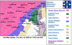
Much of the area is under a Winter Storm Warning Wednesday and Wednesday night. Other areas are under Winter Storm Watches or Winter Weather Advisories. For the absolute latest updates from NWS click on the image above.
Much of the area is under a Winter Storm Warning Wednesday and Wednesday night. Other areas are under Winter Storm Watches or Winter Weather Advisories. For the absolute latest updates from NWS click on the image above.
WINTER STORM WARNING
URGENT - WINTER WEATHER MESSAGE
National Weather Service Baltimore MD/Washington DC
400 PM EST Tue Dec 15 2020

Nelson-Albemarle-Greene-Madison-
400 PM EST Tue Dec 15 2020

...WINTER STORM WARNING IN EFFECT FROM 7 AM WEDNESDAY TO 4 AM EST
THURSDAY...

* WHAT...Heavy mixed precipitation expected. Total snow and sleet
  accumulations of 2 to 4 inches and ice accumulations of around a
  quarter inch

* WHERE...Nelson, Albemarle, Greene and Madison Counties.

* WHEN...From 7 AM Wednesday to 4 AM EST Thursday. Snow will begin
  between 8 and 10 AM and change to sleet and freezing rain during
  the early afternoon.

* IMPACTS...Power outages and tree damage are likely due to the
  ice. Travel could be nearly impossible. The hazardous
  conditions could impact the morning or evening commute.

* ADDITIONAL DETAILS...Visibility will be reduced below one mile
  at times in snow.

PRECAUTIONARY/PREPAREDNESS ACTIONS...

If you must travel, keep an extra flashlight, food, and water in
your vehicle in case of an emergency.

When venturing outside, watch your first few steps taken on
steps, sidewalks, and driveways, which could be icy and slippery,
increasing your risk of a fall and injury.
URGENT - WINTER WEATHER MESSAGE
National Weather Service Baltimore MD/Washington DC
400 PM EST Tue Dec 15 2020

Augusta-Rockingham-Shenandoah-Page-Warren-Western Highland-
Eastern Highland-Western Pendleton-Eastern Pendleton-
400 PM EST Tue Dec 15 2020

...WINTER STORM WARNING REMAINS IN EFFECT FROM 7 AM WEDNESDAY TO
4 AM EST THURSDAY...

* WHAT...Heavy mixed precipitation expected. Total snow and sleet
  accumulations will range from 4 to 8 inches near and east of
  I-81 in the central Shenandoah Valley, to 8 to 12 inches in most
  other locations. Up to a quarter inch of ice will be possible
  near and east of I-81.

* WHERE...Portions of northwest and western Virginia and eastern
  West Virginia.

* WHEN...From 7 AM Wednesday to 4 AM EST Thursday. Snow will
  overspread the area between 8 and 10 AM. Snow will mix with
  sleet and freezing rain during the afternoon and evening,
  especially over the central Shenandoah Valley.

* IMPACTS...Travel could be very difficult to impossible. The
  hazardous conditions could impact the morning or evening
  commute.

* ADDITIONAL DETAILS...Visibility will be reduced below one-
  quarter mile at times in snow.

PRECAUTIONARY/PREPAREDNESS ACTIONS...

If you must travel, keep an extra flashlight, food, and water in
your vehicle in case of an emergency.

When venturing outside, watch your first few steps taken on
steps, sidewalks, and driveways, which could be icy and slippery,
increasing your risk of a fall and injury.
URGENT - WINTER WEATHER MESSAGE
National Weather Service Baltimore MD/Washington DC
400 PM EST Tue Dec 15 2020
Rappahannock-Northern Virginia Blue Ridge-
Central Virginia Blue Ridge- (Editor's Note via BRL :Including Big Meadows-Wintergreen-Afton MountainHumpback Rocks & Montebello)
400 PM EST Tue Dec 15 2020
...WINTER STORM WARNING REMAINS IN EFFECT FROM 7 AM WEDNESDAY TO
4 AM EST THURSDAY...* WHAT...Heavy mixed precipitation expected. Total snow and sleet
accumulations of 4 to 8 inches and ice accumulations of two
tenths to four tenths of an inch.
* WHERE...Central Virginia Blue Ridge and Northern Virginia Blue
Ridge, and Rappahannock County.
* WHEN...From 7 AM Wednesday to 4 AM EST Thursday. Snow will
overspread the area between 8 and 10 AM. Snow will mix with
sleet and freezing rain during the afternoon and evening.
* IMPACTS...Power outages and tree damage are likely due to the
ice. Travel could be nearly impossible. The hazardous
conditions could impact the morning or evening commute.
* ADDITIONAL DETAILS...Visibility will be reduced below one-
quarter mile at times in snow.
PRECAUTIONARY/PREPAREDNESS ACTIONS...
If you must travel, keep an extra flashlight, food, and water in
your vehicle in case of an emergency.
When venturing outside, watch your first few steps taken on
steps, sidewalks, and driveways, which could be icy and slippery,
increasing your risk of a fall and injury.
URGENT - WINTER WEATHER MESSAGE
National Weather Service Blacksburg VA
233 PM EST Tue Dec 15 2020

...Wintry precipitation is expected on Wednesday...

.A complex low pressure system will bring a wintry mix of snow,
sleet, and freezing rain across portions of the Mid Atlantic on
Wednesday. Temperatures will be at or below freezing early
Wednesday morning due to cold air trapped against the Blue Ridge.
Meanwhile, warmer air aloft will advance northward overtop of the
cold air to bring wintry mixed precipitation. The system is
expected to exit the region by Wednesday evening.

Ashe-Alleghany NC-Watauga-Bland-Giles-Wythe-Pulaski-Montgomery-
Grayson-Carroll-Floyd-Craig-Alleghany VA-Bath-Roanoke-Botetourt-
Rockbridge-Patrick-Franklin-Bedford-Amherst-Mercer-Summers-Monroe-
Eastern Greenbrier-Western Greenbrier-
Including the cities of West Jefferson, Sparta, Boone, Bland,
Pearisburg, Wytheville, Radford, Pulaski, Blacksburg,
Independence, Whitetop, Troutdale, Volney, Galax, Floyd,
New Castle, Clifton Forge, Covington, Hot Springs, Roanoke,
Salem, Fincastle, Lexington, Buena Vista, Stuart, Rocky Mount,
Amherst, Bluefield, Hinton, Hix, Union, Lewisburg,
White Sulphur Springs, Quinwood, Duo, and Rainelle
233 PM EST Tue Dec 15 2020

...WINTER STORM WARNING REMAINS IN EFFECT FROM MIDNIGHT TONIGHT
TO MIDNIGHT EST WEDNESDAY NIGHT...

* WHAT...Heavy mixed precipitation expected. Total snow and
  sleet accumulations of 3 to 5 inches and ice accumulations of
  up to one tenth of an inch.

* WHERE...Portions of central, south central, southwest and west
  central Virginia and southeast West Virginia.

* WHEN...From midnight tonight to midnight EST Wednesday night.

* IMPACTS...Travel could be very difficult. The hazardous
  conditions could impact the morning or evening commute.


PRECAUTIONARY/PREPAREDNESS ACTIONS...

If you must travel, keep an extra flashlight, food, and water in
your vehicle in case of an emergency.

The latest road conditions for the state you are calling from can
be obtained by calling 5 1 1.

