
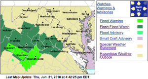
 Click on image above for absolute latest updates
941 PM EDT THU JUN 21 2018
The National Weather Service in Sterling Virginia has extended the
* Flood Warning for…
The City of Charlottesville in central Virginia…
Albemarle County in central Virginia…
Greene County in central Virginia…
* Until 430 AM EDT Friday.
* At 938 PM EDT, emergency management indicated that several roads
still remain closed across Albermarle and Greene counties.
Additional rainfall is expected to move in overnight which could
aggravate the ongoing flooding problems.
* Some locations that may experience flooding include…
Charlottesville, Crozet, Stanardsville, Schuyler, Free Union,
Campbell, Westmoreland, Hollymead, Ruckersville, Ivy, Scottsville,
Esmont, North Garden, Yancey Mills, Stony Point, Amicus, Scott
Stadium, Damon, Greenwood and Boonesville.
741 PM EDT THU JUN 21 2018
…THE FLOOD WARNING HAS BEEN CANCELLED FOR NELSON COUNTY…
The heavy rain has ended. Therefore, the flooding threat has ended.
Flood Warning
National Weather Service Baltimore MD/Washington DC
423 PM EDT THU JUN 21 2018
Nelson VA-City of Charlottesville VA-Albemarle VA-Greene VA-
423 PM EDT THU JUN 21 2018
The National Weather Service in Sterling Virginia has issued a
* Flood Warning for…
Nelson County in central Virginia…
The City of Charlottesville in central Virginia…
Albemarle County in central Virginia…
Greene County in central Virginia…
* Until 1030 PM EDT Thursday.
* At 423 PM EDT, Doppler radar indicated thunderstorms producing
heavy rain which will cause flooding. Up to two inches of rain have
already fallen.
* Some locations that may experience flooding include…
Charlottesville, Crozet, Shipman, Stanardsville, Schuyler, Free
Union, Wintergreen, Montebello, Campbell, Westmoreland, Hollymead,
Ruckersville, Nellysford, Ivy, Arrington, Scottsville, Esmont,
Lovingston, Allens Creek and North Garden.
PRECAUTIONARY/PREPAREDNESS ACTIONS…
A Flood Warning means that flooding is imminent or occurring. All
interested parties should take necessary precautions immediately.
Flood Watch
National Weather Service Baltimore MD/Washington DC
125 PM EDT Thu Jun 21 2018
VAZ025-026-029-036>040-050-051-503-504-507-508-WVZ505-506-220130-
/O.CON.KLWX.FF.A.0010.180621T1900Z-180622T1000Z/
/00000.0.ER.000000T0000Z.000000T0000Z.000000T0000Z.OO/
Augusta-Rockingham-Page-Nelson-Albemarle-Greene-Madison-
Rappahannock-Orange-Culpeper-Western Highland-Eastern Highland-
Northern Virginia Blue Ridge-Central Virginia Blue Ridge-
Western Pendleton-Eastern Pendleton-
Including the cities of Staunton, Waynesboro, Stuarts Draft,
Harrisonburg, Luray, Shenandoah, Stanley, Lovingston,
Charlottesville, Stanardsville, Madison, Washington, Orange,
Gordonsville, Culpeper, Hightown, Monterey, Big Meadows,
Wintergreen, Riverton, Brandywine, Franklin, Oak Flat, Ruddle,
and Sugar Grove
125 PM EDT Thu Jun 21 2018
…FLASH FLOOD WATCH REMAINS IN EFFECT THROUGH LATE TONIGHT…
The Flash Flood Watch continues for
* Portions of Virginia and eastern West Virginia, including the
following areas, in Virginia, Albemarle, Augusta, Central
Virginia Blue Ridge, Culpeper, Eastern Highland, Greene,
Madison, Nelson, Northern Virginia Blue Ridge, Orange, Page,
Rappahannock, Rockingham, and Western Highland. In eastern
West Virginia, Eastern Pendleton and Western Pendleton.
* Through late tonight
* Multiple rounds of heavy rain are possible. Rainfall amounts
will be between 1 and 3 inches on average, but localized much
higher amounts are possible in areas that receive multiple
rounds of heavy rain.
* Rapid rises in water due to excessive rain are possible.
Streams and creeks could quickly exceed bankfull. Roads may
become blocked by high water. Mudslides are possible in areas
where heavy rain persists over higher terrain.
PRECAUTIONARY/PREPAREDNESS ACTIONS…
Be prepared to act quickly to protect your life should water
begin rising or a warning be issued, especially if you live in an
area prone to flooding.
