REFRESH Nelson County Life Magazine HERE for the latest updates.

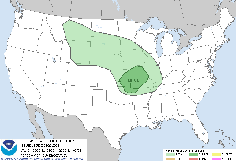
The latest severe weather outlook area.
Conditions are developing across Central Virginia that are favorable for possible severe weather later today. Though not a sure bet at this time, dynamics are beginning to line up for at least some organized severe weather this afternoon.
By early Saturday morning, as you can see in the widget to the left, a tornado watch was already in place not too far away in portions of OH, WV, MD, and SW PA. And now much of the northern 1/3 of Virginia as of 12 noon EDT, continuing until 5PM.. This is part of the same system that may affect Nelson later today.
In the morning NWS hazardous weather outlook, the risk is defined:
DAY ONE…TODAY AND TONIGHT
A TORNADO WATCH IS IN EFFECT ACROSS THE PANHANDLE OF WEST
VIRGINIA…MARYLAND WEST OF THE CHESAPEAKE BAY AND MOST OF
NORTHERN VIRGINIA THROUGH 5 PM. AUGUSTA…NELSON AND ALBEMARLE
COUNTIES ARE NOT INCLUDED IN THE TORNADO WATCH.THE REMNANTS OF THE THUNDERSTORM COMPLEX WILL MOSTLY AFFECT
WESTERN MARYLAND…THE PANHANDLE OF WEST VIRGINIA AND THE
METROPOLITAN AREAS OF BALTIMORE AND WASHINGTON DC BEFORE NOON.
HOWEVER…ADDITIONAL STORMS ARE ANTICIPATED THIS AFTERNOON AHEAD
OF THE APPROACHING COLD FRONT FOR THE ENTIRE AREA THROUGH 5 PM.
SEVERE THUNDERSTORMS WILL BE CAPABLE OF PRODUCING WIND GUSTS OF 60
MPH OR GREATER AND LARGE HAIL. AN ISOLATED TORNADO IS ALSO
POSSIBLE..DAYS TWO THROUGH SEVEN…SUNDAY THROUGH FRIDAY
ISOLATED TO SCATTERED THUNDERSTORMS ARE POSSIBLE SUNDAY AFTERNOON
AND EVENING. LOCALLY GUSTY WINDS AND SMALL HAIL WILL BE POSSIBLE
IN THE STRONGER STORMS.
Again this isn’t a sure bet that we’ll see anything, but does warrant keeping an eye out throughout the day for severe weather.
We’ll be updating here often if severe weather becomes a threat. And you can always get the latest information updated automatically on the left side of your screen in the weather widgets and RSS feeds.
NCL

