Updated: 6.30.07 3:27 PM EDT
Photography by Tommy Stafford
Nelson County Life Magazine – Copyright 2007
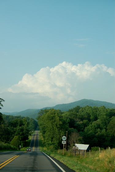
Thunderstorm in the distance Friday afternoon
Route 151 looking north
Roseland, Virginia
Friday was a mixed bag of weather across Nelson and Central Virginia. We started cloudy and ended cloudy with some sunshine and a few rumbles of thunder in between. It wasn’t as unpleasant as the start of the week. Temps were milder, but the humidity hung in there. Here at NCL-Nelson County Life Magazine we reached an afternoon high of 84 and picked up about .02″ of rain by midnight.The Friday high was 10 degrees cooler than the day before, but again, with the humidity it still felt pretty sticky.
Saturday, in particular the first part of the day, will be a transitional time where we will see clouds, perhaps a shower, then some sun and the beginning of milder, more dry air by the end of the day. On local satellite there are some breaks showing. The tendency is toward more clear skies, but it will take a few hours for the clearing line to get in here and it may be late in the day before the real clearing takes place.
On the current surface map, a cold front is working its way through the area, but has become a bit stationary across Central Virginia. It will get through here on Saturday, but as long as it’s in the area clouds will hang in and an isolated shower will be possible. The bulk of rain and showers will be south. Clearing works in from north to south.
Current-Sat Surface Map

On the National Forecast Map, by late afternoon the front works through the Nelson area. Thunderstorms are possible to points south, but clearing skies will be the tendency over the next 24 hours.
Today’s Forecast Map

Chances for any organized severe weather slip way to our south closer to the Carolinas.
Today’s slight risk area for severe weather outlined in green

*Remainder of SaturdaySpotty showers especially southern Nelson. Saturday afternoon look for partly cloudy skies late with drier air moving in, less humidity.
*High temps in Roseland, Greenfield, and Lovingston around 83 to 85 degrees.
*On the mountains above 2000 feet along the BRP, Wintergreen, Three Ridges, Devil’s Knob, and Montebello, Scattered showers with fog until late evening. Highs top out around 73 degrees. Winds NE 5-10 MPH
*Saturday night Clearing skies, patchy fog & mild.
*Lows valley around 60 degrees.
*On the mountains overnight low around 55.
*Winds N 5-10 MPH.
*In the extended weekend outlook
Sunday Sunny & nice! with NE winds at 5-10 MPH
*High 82 valley – near 73 on mountains.
Monday Sunny & mild Highs around 80 valley around 74 mountains. Overnight lows generally in the mid 50’s valley, & low and mid 50’s mountains. By Tuesday skies remain mostly sunny with highs in the lower 80’s.
Next Wed on July 4th look for warmer temps to return with slight chances of widely scattered afternoon thunderstorms back in the forecast. High temps nearing 90.
Remember when severe weather or news breaks out, come here. We’ll have all of the latest watches, warnings, and coverage affecting Nelson County, Wintergreen, and nearby counties.
Have a great weekend!
Know your Nelson
-T-
