Photography by Christina Kline
Nelson County Life Magazine – Copyright 2007
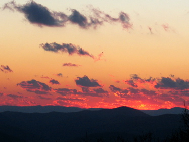
Sunset from Wintergreen
Wintergreen Mountain, Virginia
Talk about a beautiful shot! Our own Nelson Outdoors writer & Blue Ridge Mountain Sports Manager Christina Kline, recently caught this great sunset shot from atop Wintergreen. A beautiful horizon ending a summer evening! Thanks for this one Christina. By the way, if you haven’t checked out her July column in NCL (page 46 lower left) take a look! She’s even got a new photo! You’re looking pretty relaxed in that one. Guess it was time Christina, the other one was only 2 years & 4 months old!
Wednesday started sunny with warming temps throughout the morning. By afternoon numerous thunderstorms moved across portions of Nelson & surrounding counties. The only
severe thunderstorm warning issued was in Albermarle late in the afternoon. It was a very muggy and hot day with temps in the mid 90’s in some locations, with a decent rain again in some spots. We have one more day to go before we begin seeing moderating temps, drier air, and a great weekend on deck!
*NCL-Nelson County Life Magazine – Greenfield
Wed high: 94.3 degrees @ 12:42 PM
.37″ of rain in the afternoon
*NCL-Tiger Fuel – Lovingston
Wed high 88.3 @ 5:34 PM
.10″ of rain in the afternoon
The current surface map shows the persistent Bermuda high pressure losing control over the next 36 hours. Today will still be hot & muggy but changes begin later tonight into Friday.
Current-Sat Surface Map

On the National Forecast Map, the Bermuda high keeps one more day of the real muggies around. An approaching cold front that will be in our area by Friday morning helps to fire up some severe weather late today into the evening. The front is south of Nelson by the weekend. It ushers in cooler temps.
Today’s Forecast Map

Slight risk area for severe storms below outlined by green line

Text from NWS regarding severe potential:
A COLD FRONT WILL CROSS THE REGION THIS EVENING. AHEAD OF THE
FRONTAL PASSAGE…SEVERE THUNDERSTORMS ARE POSSIBLE ACROSS THE
AREA LATE THIS AFTERNOON AND EVENING. DAMAGING WINDS AND HEAVY
RAINFALL ARE THE BIGGEST THREATS.
Local forecast
*Today Early morning fog in areas that saw rain on Wednesday, burning off by mid morning. Partly cloudy with scattered thunderstorms developing by afternoon. Some possibly severe by evening.
*High temps in Nellysford, Hickory Creek, and Arrington 94 degrees.
*On the mountains above 2000 feet along the BRP, Wintergreen, Three Ridges, Devil’s Knob, and Love, Mostly sunny – partly cloudy in the afternoon with scattered thunderstorms. Highs top out around 83 degrees. Winds SW 5-10.
*Tonight Mostly cloudy with a 50% chance of thunderstorms becoming more widespread by daylight Friday.
*Lows valley 67 degrees.
*On the mountains overnight low of 65.
*Winds W 5-10 MPH.
*In the extended outlook
Friday Mostly cloudy – numerous thunderstorms and rain showers over 60% of the area.
*High 83 valley – 76 on mountains.
Saturday Spotty sunshine in the morning with diminishing showers. Partly sunny by afternoon and milder. Highs around 80 valley – around 73 mountains. Overnight lows generally in the mid & upper 50’s valley & mountains. The remainder of the weekend looks dry and mild with afternoon temps around 80 again on Sunday.
The 4th of July wild guess at this point (you know how I feel about those long term forecasts) looks partly cloudy, afternoon thunderstorms possible, highs in the mid 80’s
Remember when severe weather or news breaks out, come here. We’ll have all of the latest watches, warnings, and coverage affecting Nelson County, Wintergreen, and nearby counties.
Have a great Thurs!
Know your Nelson
-T-
