
Central Virginia Blue Ridge
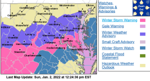
A Winter Storm Warning has been issued for all of Nelson County including the mountains of Wintergreen, Montebello, Afton and Humpback Rocks. The warning also includes some surrounding counties. Additional winter weather products have also been issued for other nearby counties. Some of those are down below. Others can be found on our weather alerts page, click here.
Tommy
WINTER STORM WARNING
URGENT - WINTER WEATHER MESSAGE
National Weather Service Baltimore MD/Washington DC
1203 PM EST Sun Jan 2 2022

Nelson-Central Virginia Blue Ridge - (Including Wintergreen)
1203 PM EST Sun Jan 2 2022

...WINTER STORM WARNING REMAINS IN EFFECT FROM 1 AM TO 1 PM EST
MONDAY...

* WHAT...Heavy snow. Additional snow accumulations of 4 to 7
  inches.

* WHERE...Central Virginia Blue Ridge, and Nelson County.

* WHEN...From 1 AM to 1 PM EST Monday.

* IMPACTS...Travel could be very difficult. The hazardous
  conditions could impact the morning commute.

PRECAUTIONARY/PREPAREDNESS ACTIONS...

If you must travel, keep an extra flashlight, food, and water in
your vehicle in case of an emergency.

When venturing outside, watch your first few steps taken on
steps, sidewalks, and driveways, which could be icy and slippery,
increasing your risk of a fall and injury.
URGENT - WINTER WEATHER MESSAGE
National Weather Service Baltimore MD/Washington DC
1203 PM EST Sun Jan 2 2022

Augusta-Albemarle-Greene-Orange-Northern Virginia Blue Ridge-
1203 PM EST Sun Jan 2 2022

...WINTER STORM WARNING IN EFFECT FROM 1 AM TO 1 PM EST MONDAY...

* WHAT...Heavy snow. Snow accumulations of 3 to 5 inches, up to 7
  inches across the higher terrain.

* WHERE...Augusta, Albemarle, Greene and Orange Counties, and
  Northern Virginia Blue Ridge.

* WHEN...From 1 AM to 1 PM EST Monday.

* IMPACTS...Travel could be very difficult. The hazardous
  conditions could impact the morning commute.

PRECAUTIONARY/PREPAREDNESS ACTIONS...

If you must travel, keep an extra flashlight, food, and water in
your vehicle in case of an emergency.

When venturing outside, watch your first few steps taken on
steps, sidewalks, and driveways, which could be icy and slippery,
increasing your risk of a fall and injury.
URGENT - WINTER WEATHER MESSAGE
National Weather Service Blacksburg VA
1142 AM EST Sun Jan 2 2022

...HEAVY SNOW TO IMPACT MONDAY MORNING COMMUTE...

.An area of low pressure will move through the Carolinas tonight
and early Monday, while cold air sinks into the southern
Appalachians behind an upper level storm system. This will bring a
change from rain to snow starting in the mountains shortly after
midnight, then reaching the piedmont around or just after dawn.
The snow will end by early afternoon.

Roanoke-Botetourt-Rockbridge-Franklin-Bedford-Amherst-
Pittsylvania-Campbell-Appomattox-Buckingham-
Including the cities of Roanoke, Salem, Fincastle, Lexington,
Buena Vista, Rocky Mount, Amherst, Danville, Lynchburg,
and Appomattox
1142 AM EST Sun Jan 2 2022

...WINTER STORM WARNING REMAINS IN EFFECT FROM 3 AM TO NOON EST
MONDAY...

* WHAT...Heavy snow expected. Total snow accumulations of 2 to 6
  inches.

* WHERE...Portions of central, south central and west central
  Virginia.

* WHEN...From 3 AM to noon EST Monday.

* IMPACTS...Travel could be difficult. The hazardous conditions
  could impact the morning commute.

* ADDITIONAL DETAILS...The gusty winds and wet snow could cause
  limbs to snap, especially along the Blue Ridge. This could
  result in power outages.

PRECAUTIONARY/PREPAREDNESS ACTIONS...

If you must travel, keep an extra flashlight, food, and water in
your vehicle in case of an emergency.

Please report snow accumulations via email at
rnk.skywarn@noaa.gov or by calling the National Weather Service
toll free at...1...866...2 1 5...4 3 2 4. Leave a message with
your observation and the specific location where it occurred. You
can also post your report to National Weather Service Blacksburg
Facebook page and on Twitter.

The latest road conditions for the state you are calling from can
be obtained by calling 5 1 1.
