
URGENT – WEATHER MESSAGE
National Weather Service Baltimore MD/Washington DC
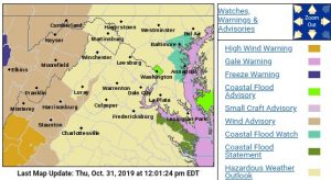
1014 AM EDT Thu Oct 31 2019
MDZ501-502-VAZ025-026-503-504-507-508-WVZ050-055-501>506-312215-
/O.CON.KLWX.WI.Y.0017.191031T2200Z-191101T0800Z/
Extreme Western Allegany-Central and Eastern Allegany-Augusta-
Rockingham-Western Highland-Eastern Highland-
Northern Virginia Blue Ridge-Central Virginia Blue Ridge-
Hampshire-Hardy-Western Grant-Eastern Grant-Western Mineral-
Eastern Mineral-Western Pendleton-Eastern Pendleton-
Including the cities of Frostburg, Cumberland, Staunton,
Waynesboro, Stuarts Draft, Harrisonburg, Hightown, Monterey,
Big Meadows, Wintergreen, Romney, Moorefield, Bayard,
Mount Storm, Petersburg, Elk Garden, Antioch, Keyser, New Creek,
Ridgeville, Russelldale, Headsville, Fort Ashby, Riverton,
Brandywine, Franklin, Oak Flat, Ruddle, and Sugar Grove
1014 AM EDT Thu Oct 31 2019
…WIND ADVISORY REMAINS IN EFFECT FROM 6 PM THIS EVENING TO 4 AM
EDT FRIDAY…
* WHAT…West winds 15 to 30 mph with gusts up to 50 mph
expected.
* WHERE…Portions of western Maryland, central, northwest and
western Virginia and eastern West Virginia.
* WHEN…From 6 PM this evening to 4 AM EDT Friday.
* IMPACTS…Gusty winds could blow around unsecured objects.
Tree limbs could be blown down and a few power outages may
result.
PRECAUTIONARY/PREPAREDNESS ACTIONS…
Use extra caution when driving, especially if operating a high
profile vehicle. Secure outdoor objects.
URGENT – WEATHER MESSAGE
National Weather Service Blacksburg VA
955 AM EDT Thu Oct 31 2019
VAZ019-020-022>024-312200-
/O.UPG.KRNK.HW.A.0003.191031T2200Z-191101T1600Z/
/O.NEW.KRNK.HW.W.0008.191031T2200Z-191101T1000Z/
Alleghany VA-Bath-Roanoke-Botetourt-Rockbridge-
Including the cities of Clifton Forge, Covington, Hot Springs,
Roanoke, Salem, Fincastle, Lexington, and Buena Vista
955 AM EDT Thu Oct 31 2019
…HIGH WIND WARNING IN EFFECT FROM 6 PM THIS EVENING TO 6 AM EDT
FRIDAY…
* WHAT…West winds 15 to 25 mph with gusts up to 60 mph
expected.
* WHERE…Alleghany VA, Bath, Roanoke, Botetourt and Rockbridge
Counties, mainly the higher elevations.
* WHEN…From 6 PM this evening to 6 AM EDT Friday.
* IMPACTS…Damaging winds will blow down trees and power lines.
Scattered power outages are expected. Travel will be difficult,
especially for high profile vehicles.
* ADDITIONAL DETAILS…Damaging winds may occur ahead of the front
with a line of showers and storms, the west to northwest winds
behind the front will bring a second surge of winds this
evening.
URGENT – WEATHER MESSAGE
National Weather Service Blacksburg VA
955 AM EDT Thu Oct 31 2019
NCZ003-004-019-020-VAZ007-009>014-032>035-043>045-WVZ042-312200-
/O.CON.KRNK.WI.Y.0019.191031T2200Z-191101T1600Z/
Surry-Stokes-Wilkes-Yadkin-Tazewell-Smyth-Bland-Giles-Wythe-
Pulaski-Montgomery-Patrick-Franklin-Bedford-Amherst-Henry-
Pittsylvania-Campbell-Mercer-
Including the cities of Dobson, Danbury, Wilkesboro, Yadkinville,
Tazewell, Marion, Bland, Pearisburg, Wytheville, Radford,
Pulaski, Blacksburg, Stuart, Rocky Mount, Bedford, Amherst,
Martinsville, Danville, Lynchburg, Bluefield, and Flat Top
955 AM EDT Thu Oct 31 2019
…WIND ADVISORY REMAINS IN EFFECT FROM 6 PM THIS EVENING TO NOON
EDT FRIDAY…
* WHAT…West winds 10 to 20 mph with gusts up to 50 mph
expected.
* WHERE…Portions of central, south central, southwest and west
central Virginia, north central and northwest North Carolina
and southeast West Virginia.
* WHEN…From 6 PM this evening to noon EDT Friday.
* IMPACTS…Gusty winds could blow around unsecured objects.
Tree limbs could be blown down and a few power outages may
result.
PRECAUTIONARY/PREPAREDNESS ACTIONS…
Use extra caution when driving, especially if operating a high
profile vehicle. Secure outdoor objects
