")
WIND ADVISORY Including Wintergreen & The BRP
Central Virginia Blue Ridge-
Including the city of Wintergreen
736 AM EDT Fri Mar 22 2019
…WIND ADVISORY IN EFFECT FROM NOON TODAY TO 4 AM EDT SATURDAY…
.TODAY…Partly sunny. Scattered rain showers this afternoon.
Windy with highs in the mid 40s. Northwest winds 20 to 30 mph
with gusts up to 45 mph. Chance of rain 40 percent.
.TONIGHT…Partly cloudy with isolated rain showers in the
evening, then mostly clear after midnight. Breezy with lows in
the upper 20s. Northwest winds 20 to 25 mph with gusts up to
50 mph. Chance of rain 20 percent.
.SATURDAY…Sunny, breezy with highs in the upper 40s. Northwest
winds 15 to 25 mph. Gusts up to 45 mph, decreasing to 35 mph in
the afternoon.
.SATURDAY NIGHT…Clear. Lows around 30. West winds 10 to 15 mph.
Gusts up to 30 mph in the evening.
.SUNDAY…Sunny. Highs in the upper 50s. Southwest winds 5 to
10 mph.
.SUNDAY NIGHT…Mostly cloudy. Lows in the lower 40s.
URGENT – WEATHER MESSAGE
National Weather Service Baltimore MD/Washington DC
408 AM EDT Fri Mar 22 2019
Washington-Extreme Western Allegany-Central and Eastern Allegany-
Augusta-Rockingham-Shenandoah-Frederick VA-Page-Warren-Clarke-
Western Highland-Eastern Highland-Northern Virginia Blue Ridge-
Central Virginia Blue Ridge-Hampshire-Morgan-Berkeley-Jefferson-
Hardy-Western Grant-Eastern Grant-Western Mineral-Eastern Mineral-
Western Pendleton-Eastern Pendleton-
Including the cities of Hagerstown, Frostburg, Cumberland,
Staunton, Waynesboro, Stuarts Draft, Harrisonburg, Strasburg,
Woodstock, Mount Jackson, New Market, Winchester, Luray,
Shenandoah, Stanley, Front Royal, Berryville, Hightown, Monterey,
Big Meadows, Wintergreen, Romney, Paw Paw, Martinsburg,
Charles Town, Shepherdstown, Moorefield, Bayard, Mount Storm,
Petersburg, Elk Garden, Antioch, Keyser, New Creek, Ridgeville,
Russelldale, Headsville, Fort Ashby, Riverton, Brandywine,
Franklin, Oak Flat, Ruddle, and Sugar Grove
408 AM EDT Fri Mar 22 2019
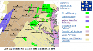
…WIND ADVISORY IN EFFECT FROM NOON TODAY TO 4 AM EDT SATURDAY…
The National Weather Service in Baltimore MD/Washington has
issued a Wind Advisory, which is in effect from noon today to
4 AM EDT Saturday.
* TIMING…The potential for strong wind gusts will increase this
afternoon and last through late tonight, especially on the
ridges.
* WINDS…Northwest 15 to 25 mph with gusts up to 50 mph. The
strongest wind gusts are generally expected on the ridges,
though some bursts of strong wind could occur in the lower
elevations during this afternoon and evening.
* IMPACTS…Strong winds may blow down limbs, trees, and power
lines. Scattered power outages are expected.
PRECAUTIONARY/PREPAREDNESS ACTIONS…
A Wind Advisory means that winds of 45 to 55 mph are expected.
Winds this strong can make driving difficult, especially for high
profile vehicles.
URGENT – WEATHER MESSAGE
National Weather Service Blacksburg VA
330 AM EDT Fri Mar 22 2019
…Strong wind gusts expected today into tonight…
.Another front moves across this morning while low pressure
deepens over New England. A tight pressure gradient will bring
stronger winds to the area today into tonight.
Ashe-Alleghany NC-Surry-Watauga-Wilkes-Tazewell-Smyth-Bland-Giles-
Wythe-Pulaski-Montgomery-Grayson-Carroll-Floyd-Craig-Alleghany VA-
Bath-Roanoke-Botetourt-Rockbridge-Patrick-Franklin-Bedford-
Amherst-Mercer-Summers-Monroe-Eastern Greenbrier-
Including the cities of West Jefferson, Sparta, Dobson, Boone,
Wilkesboro, Tazewell, Marion, Bland, Pearisburg, Wytheville,
Radford, Pulaski, Blacksburg, Independence, Whitetop, Troutdale,
Volney, Galax, Floyd, New Castle, Clifton Forge, Covington,
Hot Springs, Roanoke, Salem, Fincastle, Lexington, Buena Vista,
Stuart, Rocky Mount, Bedford, Amherst, Bluefield, Flat Top,
Hinton, Hix, Union, Lewisburg, White Sulphur Springs,
and Alderson
330 AM EDT Fri Mar 22 2019
…WIND ADVISORY IN EFFECT UNTIL 6 AM EDT SATURDAY…
The National Weather Service in Blacksburg has issued a Wind
Advisory, which is in effect until 6 AM EDT Saturday.
* Winds…Northwest 15 to 30 mph with gusts up to 50 mph.
* Timing…Today through tonight. Strongest will be this afternoon
and evening.
* Impacts…Downed tree limbs and weaker trees. Isolated power
outage. Loose outdoor objects will be blown around. High profile
vehicles will have difficulty driving.
* Locations…From the foothills of Virginia and North Carolina
west into the mountains of West Virginia.
* Hazards…Strong winds.
PRECAUTIONARY/PREPAREDNESS ACTIONS…
A Wind Advisory is issued when sustained winds are forecast to be
31 to 39 MPH or gusts will range between 46 and 57 MPH. Winds of
these magnitudes may cause minor property damage without extra
precautions. Motorists in high profile vehicles should use extra
caution until the winds subside.
