
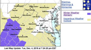
WINTER WEATHER ADVISORY
URGENT – WINTER WEATHER MESSAGE
National Weather Service Baltimore MD/Washington DC
636 PM EST Tue Dec 4 2018
VAZ025-026-036-508-050745-
/O.NEW.KLWX.WW.Y.0026.181205T0900Z-181205T1700Z/
Augusta-Rockingham-Nelson-Central Virginia Blue Ridge-
636 PM EST Tue Dec 4 2018
…WINTER WEATHER ADVISORY IN EFFECT FROM 4 AM TO NOON EST
WEDNESDAY…
* WHAT…Light snow expected to begin late tonight, and continue
through Wednesday morning. Total snow accumulation of one to two
inches are expected, with local accumulations up to three
inches at elevations about 2000 feet.
* WHERE…Augusta, Rockingham and Nelson Counties, and Central
Virginia Blue Ridge.
* WHEN…From 4 AM to noon EST Wednesday.
* ADDITIONAL DETAILS…Plan on slippery road conditions. The
hazardous conditions could impact the morning commute.
PRECAUTIONARY/PREPAREDNESS ACTIONS…
A Winter Weather Advisory for snow means periods of snow will
cause primarily travel difficulties. Expect snow covered roads
and limited visibilities, and use caution while driving.
The latest road conditions for the state you are calling from can
be obtained by calling 5 1 1.
&&
$$
URGENT – WINTER WEATHER MESSAGE
National Weather Service Blacksburg VA
235 PM EST Tue Dec 4 2018
…Light accumulating snows expected tonight into Wednesday…
.An upper-level disturbance moving out of the central Plains
interacting with a cold air mass will produce an increase in
coverage of snow showers tonight. Potential exists for short-lived
bursts of snow that may cause difficult travel conditions for the
Wednesday morning commute. While snow showers generally cease by
mid-morning Wednesday in most areas, a longer period of continued
accumulating snow expected across the mountains in southeastern
West Virginia.
VAZ010>014-016>020-022>024-033>035-045>047-WVZ044-507-050400-
/O.NEW.KRNK.WW.Y.0022.181205T0500Z-181205T1400Z/
Bland-Giles-Wythe-Pulaski-Montgomery-Carroll-Floyd-Craig-
Alleghany VA-Bath-Roanoke-Botetourt-Rockbridge-Franklin-Bedford-
Amherst-Campbell-Appomattox-Buckingham-Monroe-Eastern Greenbrier-
Including the cities of Bland, Pearisburg, Wytheville, Radford,
Pulaski, Blacksburg, Galax, Floyd, New Castle, Clifton Forge,
Covington, Hot Springs, Roanoke, Salem, Fincastle, Lexington,
Buena Vista, Rocky Mount, Amherst, Lynchburg, Appomattox, Union,
Lewisburg, and White Sulphur Springs
235 PM EST Tue Dec 4 2018
…WINTER WEATHER ADVISORY IN EFFECT FROM MIDNIGHT TONIGHT TO
9 AM EST WEDNESDAY…
* WHAT…Snow expected. Total snow accumulations of up to one inch
expected, which will likely impact the Wednesday morning
commute.
* WHERE…Monroe and eastern Greenbrier County in West
Virginia…as well as the New River and Roanoke Valleys,
Alleghany Highlands, southern Shenandoah Valley and the central
Virginia Piedmont in Virginia.
* WHEN…From midnight tonight to 9 AM EST Wednesday.
* ADDITIONAL DETAILS…Plan on slippery road conditions. The
hazardous conditions likely will impact the morning commute.
PRECAUTIONARY/PREPAREDNESS ACTIONS…
A Winter Weather Advisory for snow means periods of snow will
cause primarily travel difficulties. Expect snow covered roads
and limited visibilities, and use caution while driving.
The latest road conditions for the state you are calling from can
be obtained by calling 5 1 1.
Loconto
