
The previously issued High Wind Watch has been replaced by a High Wind Warning click here to see that.
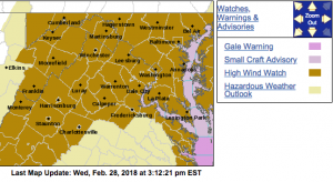
HIGH WIND WATCH
URGENT – WEATHER MESSAGE
National Weather Service Baltimore MD/Washington DC
252 PM EST Wed Feb 28 2018
District of Columbia-Frederick MD-Carroll-Northern Baltimore-
Southern Baltimore-Prince Georges-Anne Arundel-Charles-St. Marys-
Calvert-Northwest Montgomery-Central and Southeast Montgomery-
Northwest Howard-Central and Southeast Howard-Northwest Harford-
Southeast Harford-Nelson-Albemarle-Greene-Madison-Rappahannock-
Orange-Culpeper-Prince William/Manassas/Manassas Park-Fairfax-
Arlington/Falls Church/Alexandria-Stafford-Spotsylvania-
King George-Northern Fauquier-Southern Fauquier-Western Loudoun-
Eastern Loudoun-
Including the cities of Washington, Frederick, Ballenger Creek,
Eldersburg, Westminster, Reisterstown, Cockeysville, Baltimore,
Bowie, Suitland-Silver Hill, Clinton, College Park, Greenbelt,
Laurel, Camp Springs, Glen Burnie, Annapolis, Severn, South Gate,
Severna Park, Arnold, Odenton, St. Charles, Waldorf,
Lexington Park, California, Chesapeake Beach, Huntingtown,
Dunkirk, North Beach, Lusby, Prince Frederick, Germantown,
Damascus, Bethesda, Rockville, Gaithersburg, Silver Spring,
Lisbon, Columbia, Ellicott City, Jarrettsville, Aberdeen,
Lovingston, Charlottesville, Stanardsville, Madison, Orange,
Gordonsville, Culpeper, Dale City, Manassas, Woodbridge,
Lake Ridge, Montclair, Reston, Herndon, Annandale, Centreville,
Chantilly, McLean, Franconia, Arlington, Alexandria, Falmouth,
Fredericksburg, Dahlgren, Warrenton, Turnbull, Purcellville,
Leesburg, Ashburn, and Sterling
252 PM EST Wed Feb 28 2018
…HIGH WIND WATCH IN EFFECT FROM LATE THURSDAY NIGHT THROUGH
LATE FRIDAY NIGHT…
The National Weather Service in Baltimore MD/Washington has
issued a High Wind Watch, which is in effect from late Thursday
night through late Friday night.
* TIMING…Overnight Thursday through Friday night.
* WINDS…Northwest 25 to 40 mph with the potential for gusts
around 60 mph.
* IMPACTS…Damaging winds will blow down trees and power lines.
Widespread power outages are possible. Travel will be
difficult, especially for high profile vehicles.
PRECAUTIONARY/PREPAREDNESS ACTIONS…
A High Wind Watch means there is the potential for a hazardous
high wind event. Sustained winds of at least 40 mph, or gusts of
58 mph or stronger may occur. Continue to monitor the latest
forecasts.
URGENT – WEATHER MESSAGE
National Weather Service Baltimore MD/Washington DC
252 PM EST Wed Feb 28 2018
Washington-Extreme Western Allegany-Central and Eastern Allegany-
Augusta-Rockingham-Shenandoah-Frederick VA-Page-Warren-Clarke-
Western Highland-Eastern Highland-Northern Virginia Blue Ridge-
Central Virginia Blue Ridge-Hampshire-Morgan-Berkeley-Jefferson-
Hardy-Western Grant-Eastern Grant-Western Mineral-Eastern Mineral-
Western Pendleton-Eastern Pendleton-
Including the cities of Hagerstown, Frostburg, Cumberland,
Staunton, Waynesboro, Stuarts Draft, Harrisonburg, Strasburg,
Woodstock, Mount Jackson, New Market, Winchester, Luray,
Shenandoah, Stanley, Front Royal, Berryville, Hightown, Monterey,
Big Meadows, Wintergreen, Romney, Paw Paw, Martinsburg,
Charles Town, Shepherdstown, Moorefield, Bayard, Mount Storm,
Petersburg, Elk Garden, Antioch, Keyser, New Creek, Ridgeville,
Russelldale, Headsville, Fort Ashby, Riverton, Brandywine,
Franklin, Oak Flat, Ruddle, and Sugar Grove
252 PM EST Wed Feb 28 2018
…HIGH WIND WATCH IN EFFECT FROM THURSDAY EVENING THROUGH LATE
FRIDAY NIGHT…
The National Weather Service in Baltimore MD/Washington has
issued a High Wind Watch, which is in effect from Thursday
evening through late Friday night.
* TIMING…Thursday night through Friday night.
* WINDS…Northwest 25 to 40 mph with the potential for gusts
around 60 mph.
* IMPACTS…Damaging winds will blow down trees and power lines.
Widespread power outages are possible. Travel will be
difficult, especially for high profile vehicles.
PRECAUTIONARY/PREPAREDNESS ACTIONS…
A High Wind Watch means there is the potential for a hazardous
high wind event. Sustained winds of at least 40 mph, or gusts of
58 mph or stronger may occur. Continue to monitor the latest
forecasts.
URGENT – WEATHER MESSAGE
National Weather Service Blacksburg VA
1055 AM EST Wed Feb 28 2018
…Very Strong Wind Thursday night into Saturday morning…
.Winds will turn to the northwest and increase behind an intense
cold front Thursday night and will continue into Saturday
morning.
Ashe-Alleghany NC-Surry-Watauga-Wilkes-Yadkin-Tazewell-Smyth-
Bland-Giles-Wythe-Pulaski-Montgomery-Grayson-Carroll-Floyd-Craig-
Alleghany VA-Bath-Roanoke-Botetourt-Rockbridge-Patrick-Franklin-
Bedford-Amherst-Henry-
Including the cities of West Jefferson, Sparta, Dobson, Boone,
Wilkesboro, Yadkinville, Tazewell, Marion, Bland, Pearisburg,
Wytheville, Radford, Pulaski, Blacksburg, Independence, Whitetop,
Troutdale, Volney, Galax, Floyd, New Castle, Clifton Forge,
Covington, Hot Springs, Roanoke, Salem, Fincastle, Lexington,
Buena Vista, Stuart, Rocky Mount, Bedford, Amherst,
and Martinsville
1055 AM EST Wed Feb 28 2018
…HIGH WIND WATCH IN EFFECT FROM THURSDAY EVENING THROUGH
SATURDAY MORNING…
The National Weather Service in Blacksburg has issued a High Wind
Watch, which is in effect from Thursday evening through Saturday
morning.
* Locations…Mountains and foothills of southwest Virginia and
northwest North Carolina.
* Hazards…Very strong to damaging wind.
* Winds…Northwest 20 to 30 mph with gusts up to 60 mph.
* Timing…Starting Thursday night and continuing into Saturday
morning.
* Impacts…Numerous downed trees and power outages likely. Minor
structural damage possible.
PRECAUTIONARY/PREPAREDNESS ACTIONS…
A High Wind Watch means there is the potential for a hazardous
high wind event. Sustained winds of at least 40 mph…or gusts of
58 mph or stronger may occur. Continue to monitor the latest
forecasts.
