
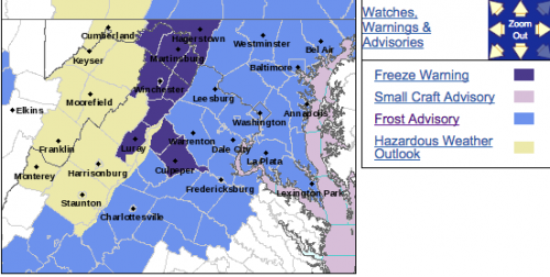
FROST ADVISORY
URGENT – WEATHER MESSAGE
National Weather Service Baltimore MD/Washington DC
1037 AM EDT Thu Oct 26 2017
District of Columbia-Frederick MD-Carroll-Northern Baltimore-
Southern Baltimore-Prince Georges-Anne Arundel-Charles-St. Marys-
Calvert-Northwest Montgomery-Central and Southeast Montgomery-
Northwest Howard-Central and Southeast Howard-Northwest Harford-
Southeast Harford-Nelson-Albemarle-Greene-Orange-
Prince William/Manassas/Manassas Park-Fairfax-
Arlington/Falls Church/Alexandria-Stafford-Spotsylvania-
King George-Northern Fauquier-Southern Fauquier-Western Loudoun-
Eastern Loudoun-
Including the cities of Washington, Frederick, Ballenger Creek,
Eldersburg, Westminster, Reisterstown, Cockeysville, Baltimore,
Bowie, Suitland-Silver Hill, Clinton, College Park, Greenbelt,
Laurel, Camp Springs, Glen Burnie, Annapolis, Severn, South Gate,
Severna Park, Arnold, Odenton, St. Charles, Waldorf,
Lexington Park, California, Chesapeake Beach, Huntingtown,
Dunkirk, North Beach, Lusby, Prince Frederick, Germantown,
Damascus, Bethesda, Rockville, Gaithersburg, Silver Spring,
Lisbon, Columbia, Ellicott City, Jarrettsville, Aberdeen,
Lovingston, Charlottesville, Stanardsville, Orange, Gordonsville,
Dale City, Manassas, Woodbridge, Lake Ridge, Montclair, Reston,
Herndon, Annandale, Centreville, Chantilly, McLean, Franconia,
Arlington, Alexandria, Falmouth, Fredericksburg, Dahlgren,
Warrenton, Turnbull, Purcellville, Leesburg, Ashburn,
and Sterling
1037 AM EDT Thu Oct 26 2017
…FROST ADVISORY REMAINS IN EFFECT FROM MIDNIGHT TONIGHT TO 9 AM
EDT FRIDAY…
* TEMPERATURES…Falling into the mid 30s by dawn, mainly away
from the urban centers and large bodies of water.
* IMPACTS…Sensitive outdoor plants may be damaged or killed by
frost if left uncovered.
PRECAUTIONARY/PREPAREDNESS ACTIONS…
A Frost Advisory means that widespread frost is expected.
Sensitive outdoor plants may be killed if left uncovered.
URGENT – WEATHER MESSAGE
National Weather Service Blacksburg VA
301 PM EDT Thu Oct 26 2017
…Frost developing late tonight…
.High pressure will bring clear skies and light winds to the
Appalachians and central mid atlantic region tonight. This will
allow temperatures to fall rapidly overnight and frost is
expected to develop across portions of Virginia east of the Blue
Ridge, as well as across the foothills and piedmont of North
Carolina.
Roanoke-Botetourt-Rockbridge-Franklin-Bedford-Amherst-Campbell-
Appomattox-Buckingham-
Including the cities of Roanoke, Salem, Fincastle, Lexington,
Buena Vista, Rocky Mount, Bedford, Amherst, Lynchburg,
and Appomattox
301 PM EDT Thu Oct 26 2017
…FROST ADVISORY NOW IN EFFECT FROM 3 AM TO 9 AM EDT FRIDAY…
* Locations…Areas of Virginia east of the Blue Ridge
* Hazards…Frost.
* Temperatures…Lows in the lower to mid 30s.
* Timing…3AM to 9AM Friday.
* Impacts…Unprotected sensitive vegetation may be damaged or
killed.
PRECAUTIONARY/PREPAREDNESS ACTIONS…
A Frost Advisory means that frost is expected. Sensitive outdoor
plants may be killed if left uncovered.
