

Central Virginia Blue Ridge
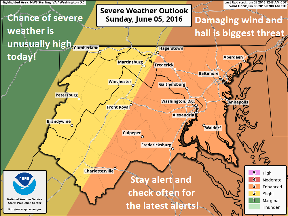
Unfortunately, Saturday night’s flooding may have just been the warm up for another round of storms later today. As shown in the graphic above, an area from roughly Charlottesville east could see strong to severe storms. Hail and damaging winds are the most likely scenarios. By far the mostly likely areas to see the strongest storms would be to the east of the Blue Ridge Parkway, but anywhere in the area shown above is not out of the question.
Much of the development depends on how much sunshine we get. If we have several hours of sunshine that would destabilize the atmosphere and cause rapid and intense severe storms. If we stay cloudy most of the day we will see less intense weather.
Regardless, it’s warrants watching and I will be updating all across our social media platforms and here.
Be safe!
Tommy

