

Nelson County, Virginia
Updated 1.24.11 @1:40PM for AccuWx Map below
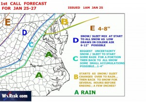
As we talked about Sunday, Nelson and much of Central Virginia is poised for a hit by some possible winter weather mid-week. David Tolleris, over at Wxrisk.com in Richmond just released his 1st call map shown above. It still shows the dividing line of rain vs wintry precip very, very close for Nelson. In general to the west of the BRP sees the absolute best chance of accumulating snow. To the east here in Nelson, good chances at Wintergreen, (higher elevations obviously) fair chances just to the east side of the BRP in places like Nellysford, Roseland, Afton, etc.
This is all about temps this time folks, we won’t know for sure, as in most cases, until we get almost up on the event itself. But we’ll start getting much better clues by tonight into tomorrow morning. But I might add, David Tolleris gets it right when others don’t. Simply because he isn’t sawed by flawed computer models or peer pressure.
Stay tuned!
Original Post from 1.23.11
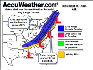

There’s a growing consensus that a significant winter storm will be affecting the Central Virgina & Appalachian regions of the US by mid week. Unlike previous storms this winter, this one will be tracking more inland vs off of the east coast then on up into New England. Though New England will see affects of this too. The one big question that remains, if of course, the exact track and how much cold air will be in place once all of the elements come together. The map above is from meteorologist Henry Margusity at accuweather.com
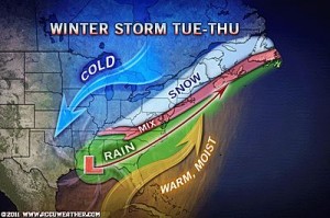

One of the elements that could destroy the prospects of heavy snowfall is much warmer air that moves in here on Tuesday. Afternoon temps will rise to the upper 40’s during the day before falling back into the low 30’s overnight. Where that line of warmer air sets up determines who sees the snow, the ice and the rain. We don’t know that yet and can’t say with any accuracy this far out.
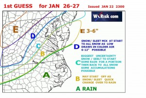

One of our favorite sources is without question, David Tolleris, over at Wxrisk.com in Richmond. David is in the business of long range predictions for agricultural and energy interests. As you can see from his map above Nelson is near the areas where we could go either snow or a mix. But DT’s discussions do lean toward folks along and near I-81 seeing a significant winter event.
It MUST be stressed this is all for discussion purposes at this point, as a deviation on the track of the storm can mean significant changes. But there is greater likelihood of seeing something this time around vs the last several storms. There is also another storm in the chute around the first few days of February. We’ll talk more on that one late this week.
Updates often over the next 48-72 hours.


[…] This post was mentioned on Twitter by Nelson County Life, Berkeley. Berkeley said: RT @nelsoncountylif: From NCL: New Post : Significant Winter Weather Possible By Mid Week http://bit.ly/hYXPqc […]