
Nelson County, Virginia
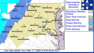
After a a good soaking overnight Saturday, skies are very slowly becoming partly cloudy over Nelson and parts of Central Virginia. A previously issued frost advisory that included counties along and west of the Blue Ridge Parkway has been cut back to the west removing those counties immediately west of the BRP. Cloud cover that was thought to be out of the area by late Sunday night has held in keeping temps up slightly.
Nelson and those counties are not officially in the frost advisory area, there is still the tiny potential for spotty light frost, in particular at elevations above 2000 feel where dewpoints had already reached 30° by 10PM Sunday night. Dewpoint readings are a good indicator many times as to how low the overnight temperature can fall. However, if skies remain cloudy for the entire night, frosting is not likely. A better potential remains overnight Monday when skies will be clear and winds will be calm.
Much of Sunday night event depends on whether or not the winds completely die down overnight into Monday morning. And, if skies clear out overnight. A gentle light breeze would also be enough to keep frost from occurring this late in the season. Forecasts right now indicate a light northerly breeze of 5 MPH overnight with clouds remaining most of the overnight hours.
The latest information over in Tommy’s Weather later tonight.
Best bet, just to be safe, cover any tender plants overnight Sunday and Monday night.

