REFRESH Nelson County Life Magazine HERE for the latest updates:
Photography by Paul Purpura
Nelson County Life Magazine : Copyright 2007
Summer Clouds above The Evans Center
Wintergreen Mountain, Virginia
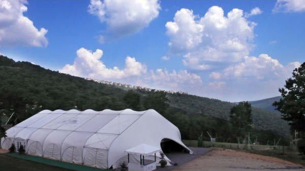
Monday we didn’t see much of the sun until later in the day because of a stubborn frontal boundary just to our north. Most of the NCL-Weathernet sites didn’t even get the high reading until late in the day. We started getting clearing in the afternoon. When we have this much humidity and heat, you see those puffy cumulus clouds like those above that our Paul Purpura got over Wintergreen. You’ll see plenty of those in the coming week with very slight chances for isolated thunderstorms each day. BUT, the real story will be the heat & humidity. Look, I was born and raised in the mid-south just north of Memphis. Other than New Orleans and the south of Florida there is no more humid place. On Monday afternoon dewpoints were running around 78 to 80 degrees. Folks that is humid, very. Combine that with heat and you just about can’t cool yourself fast enough.
I’m not one of those that panics every time the sun shines. It’s part of life. You know, it’s why they call it summer! Heat Advisories and ozone action days are way to “buzzy” for me. However, this week will be one of those rare times I do think taking it easy in the hot of the day is in order! Hence the Heat Advisory from the NWS:
HEAT ADVISORY IN EFFECT FROM 12 PM TO 8 PM EDT TUESDAY…
THE NATIONAL WEATHER SERVICE IN STERLING VIRGINIA HAS ISSUED A
HEAT ADVISORY…WHICH IS IN EFFECT FROM 12 PM TO 8 PM EDT
TUESDAY.HIGH TEMPERATURES TUESDAY BETWEEN 95 AND 100 DEGREES WILL COMBINE
WITH A HUMID AIRMASS TO YIELD A HEAT INDEX BETWEEN 105 AND 110
DEGREES. SIMILAR CONDITIONS ARE POSSIBLE ONCE AGAIN WEDNESDAY.
We’ll be dealing with hot & humid conditions for most of the week. By week’s end look for moderating temps and temps back in the 80’s by the weekend.
Here’s the numbers from Monday: As of 11:59 PM EDT Monday night
*NCL-Nelson County Life Magazine : Greenfield / Afton
Mon High: 89.4 degrees @ 6:03 PM
Dewpoint: 79.3 @ 3:36 PM
0.00″ of rain
*NCL-Wintergreen Nature Foundation : Devil’s Knob
Mon High: 78.4 degrees @ 3:30 PM
Dewpoint: 68.5 @ 1:59 PM
0.06″ of rain
*NCL-Wintergreen Winery @ the foot of Wintergreen Mountain : Beech Grove
Mon High: 92.3 degrees @ 4:58 PM
Dewpoint: 75.5 @ 6:49 PM
0.04″ of rain
*NCL-Delfosse Vineyard & Winery near Hickory Creek : Faber
Mon High: 87.1 degrees @ 6:09 PM
Dewpoint: 78.3 @ 3:36 PM
0.04″ of rain
*NCL-Tiger Fuel – Lovingston
Mon High: 89.2 degrees @ 4:48 PM
Dewpoint: 75.7 @ 3:31 PM
0.04″ of rain
*NCL-Mini Tara Vineyards : Arrington
Mon High: 89.2 degrees @ 6:18 PM
Dewpoint: 74.5 @ 6:37 PM
0.00″ of rain
The current surface map shows an area of high pressure at the surface over our area for the next 24 hours. Chances for thunderstorms are minimal. It will be very hot and humid.
Current-Sat Surface Map

On the National Forecast Map, no real systems get into the area for at least 24-36 hours. A weak boundary may slip in by Wednesday lowering the humidity a bit, but temps will still be near 100.
Today’s Forecast Map

Local forecast
*Tuesday Heat advisory from 12 noon until 8PM. Patchy fog in the morning then mostly sunny hot and humid with heat index near 105.
*High temps in Nellysford, Lovingston & Amherst 98 to 100 degrees.
*On the mountains above 2000 feet along the BRP, Wintergreen, Three Ridges, Devil’s Knob, and Love, Early morning fog, then mostly sunny. Warm & muggy.
Highs top out around 88 degrees.
Winds NE winds shifting S around 3-5 MPH
*Tuesday night Partly cloudy & muggy.
*Lows valley around 73 degrees.
*On the mountains overnight low of 72.
*Winds SSW 3-5 MPH.
*Wednesday Partly sunny and very hot. Heat index 105 to 110
*High temp around 100 degrees.
*On the mountains Partly sunny hot and humid with an afternoon high near 90.
Winds W 10-15 shifting NW in the afternoon
Thursday Mostly sunny, slightly cooler highs in the lower 90’s.
Friday highs in the lower 90’s for daytime highs and overnight lows around 70. Slightly cooler mountains. Slight chances for afternoon thunderstorms Friday.
By the weekend look for temps cooling into the mid 80’s.
Remember when severe weather or news breaks out, come here. We’ll have all of the latest watches, warnings, and coverage affecting Nelson County, Wintergreen, and nearby counties.
Have a great Tuesday!
Know your Nelson
-T-
