Good Thursday morning!
A pretty uneventful day on tap for most of the area. If you think it’s been a cool or cold several weeks you are right. Was reading the discussion this morning from the NWS office in DC / Sterling:
Past 12 days balt (Baltimore) as cold as ever
recorded. District of Columbia is 2nd coldest. Another day of continue cool temperatures is on
tap for the area as the now distant upper low still has enough
influence to keep the flow out of the NE off the water.
Has been a pretty cool and damp month. Hang on that is about to change!
Days like this are a mere 24 hours away.
Photo by Paul Purpura for NCL Magazine – Lake Monacan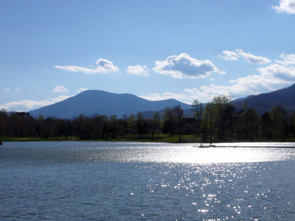
Thanks Paul for a great shot from earlier this week. Days like this are around the corner with a huge warm up headed our way next week. We’ll easily make it into the 70’s this coming weekend, again just in time for the Pharsalia Folk Festival. Know Foxie and Dick have been working hard out at Pharsalia to get it ready. Be sure you make it either Saturday or Sunday, or both!
Thursday look for mainly cloudy skies for pretty much the entire day. Temps without any sun will barely make it into the mid 50’s valley and mid to upper 40’s mountain. Light NE winds. We’ll see some light showers from time to time, but that’s about it. Tonight clouds remain with a passing shower. With clouds in place temps only fall to around 40 valley and upper 30’s mountains.
Here’s where it gets better. Friday we’ll start out with clouds moving to mostly sunny skies in the afternoon and temps in the upper 60’s valley, around 60 mountains. Friday night clear with temps generally around 40.
Saturday sunny temps low 70’s valley low 60’s mountain
Sunday sunny temps in the mid 70’s valley – mid 60’s mountain.
By next week we’re talking 80’s! – I am ready!
Everyone have a great Thursday,
-T-
