Good Thurs evening and Friday morning to all,
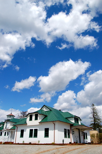
What a beautiful day on Thursday. Yvette and I spent some time over at Oak Ridge looking over their new facilities. Heather showed us the new building, what a beautiful place. Check out the sky in this picture below. This is the old carriage house on the property.
Wish I had better news for everyone over the next 48 to 72 hours, but it doesn’t look like a very good weekend shaping up temp wise or sky wise. Overnight Thursday pretty boring – temps fall to the upper 30’s overnight generally speaking. Enjoy Friday, it’ll be the last really nice day until next week around Monday when we have partly sunny skies back and temps in the 50’s.
Friday looks to be in the low 60’s valley and 50’s mountains with plenty of sun. By Friday night showers roll in after midnight and continue really until Sunday night when it tapers off as it changes to, yes…snow again. I give up! Not widespread snow, just heavy wet flakes that really do nothing. Just reminds you it’s still spring and not summer. The obvious better chances are in the mountains at places like Montebello, Wintergreen, Afton Mountain, Love, Ennis. Though even the valley could see some snow as the system pulls out of here and some colder air filters in. Generally speaking next week after this mess is out of here we can expect milder temps in the 60’s for daytime highs and overnight lows in the 40’s.
The system this weekend has the potential to produce some pretty heavy rain. The folks at the weather service mention this Thurs night in their discussion:
Area quantitative precipitation forecast of 1 to 2 inches seems likely. Ptype is still uncertain
with some wet snow likely in higher terrain to northwest.
There is also more discussion about snow, though no real widespread concerns:
This system is unusually strong for middle April. Expect the main snow
threat to be confined to the Blue Ridge and west…and mainly
above 1500 feet. Further…any snow that does fall will have a very
hard time sticking to pavement. Bottom line…something to continue
to watch…but at this time think that if there is any snow it will
not cause much in the way of problems
.
The one silver lining I do see, Saturday won’t be a complete washout everywhere. Though cool, the majority of the rain moves in later in the day and then stays around till late Sunday night.
Was talking to Dr. Jim Rice today in Nellysford, time to get the chompers cleaned again, and he mentioned that he was in Florida last week. Says he wishes he could bring the weather from there here….I agree, boy do I agree!
Just remember, we’re only days from really warm temps, cut off jeans, and the days of summer, but you sure couldn’t tell it right now!
Have a good Thurs evening and early Fri morning.
More later in the day Friday,
Tommy
